Difference between revisions of "Template:Europe and seas labelled map"
Jump to navigation
Jump to search
imported>HermanHn |
(rvt unexplained/undiscussed name change, -wt sp) |
||
| Line 81: | Line 81: | ||
{{Image label small|x=0.685|y=0.735|scale=700|text=''<font color="#E2EBF5">[[Aegean Sea|Sea]]</font>''}} | {{Image label small|x=0.685|y=0.735|scale=700|text=''<font color="#E2EBF5">[[Aegean Sea|Sea]]</font>''}} | ||
{{Image label small|x=0.59|y=0.16|scale=700|text=''<font color="#E2EBF5">[[Barents Sea]]</font>''}} | {{Image label small|x=0.59|y=0.16|scale=700|text=''<font color="#E2EBF5">[[Barents Sea]]</font>''}} | ||
| − | {{Image label small|x=0. | + | {{Image label small|x=0.32|y=0.55|scale=700|text=[[Bay of Biscay|<font color="#E2EBF5">''Bay of<br />Biscay''</font>]]}} |
{{Image label small|x=0.76|y=0.585|scale=700|text=[[Black Sea|<font color="#E2EBF5">''Black<br />Sea''</font>]]}} | {{Image label small|x=0.76|y=0.585|scale=700|text=[[Black Sea|<font color="#E2EBF5">''Black<br />Sea''</font>]]}} | ||
{{Image label small|x=0.80|y=0.56|scale=700|text=[[Sea of Azov|<font color="#E2EBF5">''Azov<br />Sea''</font>]]}} | {{Image label small|x=0.80|y=0.56|scale=700|text=[[Sea of Azov|<font color="#E2EBF5">''Azov<br />Sea''</font>]]}} | ||
| Line 119: | Line 119: | ||
{{Image label end}} | {{Image label end}} | ||
| − | {{Image label end}} | + | {{Image label end}}<noinclude> |
| − | <noinclude> | ||
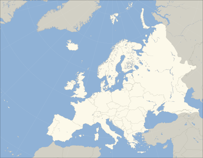
Clickable map of Europe, showing one of the most commonly used geographical boundaries (as used by [[National Geographic]] and [[Encyclopedia Britannica]], for example. Whether countries are considered in Europe or Asia can vary in sources, for example in the classification of the [[CIA World Factbook]] or that of the [[BBC]]). | Clickable map of Europe, showing one of the most commonly used geographical boundaries (as used by [[National Geographic]] and [[Encyclopedia Britannica]], for example. Whether countries are considered in Europe or Asia can vary in sources, for example in the classification of the [[CIA World Factbook]] or that of the [[BBC]]). | ||
Revision as of 01:05, 9 April 2010
Clickable map of Europe, showing one of the most commonly used geographical boundaries (as used by National Geographic and Encyclopedia Britannica, for example. Whether countries are considered in Europe or Asia can vary in sources, for example in the classification of the CIA World Factbook or that of the BBC).
Legend: blue = transcontinental states; green = historically European but geographically outside Europe's boundaries. ab:Шаблон:Европа cs:Šablona:Mapa Evropy id:Templat:Peta Eropa ja:Template:ヨーロッパ地図 km:ទំព័រគំរូ:អឺរ៉ុប និង សមុទ្រ ro:Format:Harta politică a Europei tr:Şablon:Avrupa haritası
