File:BlankMap-World.svg

Original file (SVG file, nominally 2,754 × 1,398 pixels, file size: 1.05 MB)
This file is from Wikimedia Commons and may be used by other projects. The description on its file description page there is shown below.
English: Editor's note:
Русский: Примечание редактора:
|
English: Note on boundaries: the map contains coding for various disputed sovereignty claims:
These classes can be changed in derivative maps by using CSS (see File_talk:BlankMap-World.svg#Selecting_and_colouring_countries on how to do that), but repeated overwriting of this file against established consensus might fall into COM:UPLOADWAR category and result in block. See instructions page for more details.Русский: Примечание по территориям: карта содержит в себе коды для территорий с нечётким правовым статусом, а именно:
Стандартное поведение этих территорий может, в производных работах, быть переопределено с помощью соответствующих CSS-классов (см. инструкцию (англ.), как это можно сделать), однако настойчивая перезапись данного файла вопреки устоявшемуся консенсусу может быть расценена как война загрузок и привести к блокировке. См. подробнее в документации файла (на англ.) |
This image should always reflect the most recent version. Feel free to update it when needed.
|
| This file may be updated to reflect new information. If you wish to use a specific version of the file without it being overwritten, please upload the required version as a separate file. |
Summary
| DescriptionBlankMap-World.svg |
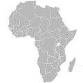
English: A detailed Robinson projection SVG map with grouping enabled to connect all non-contiguous parts of a country's territory for easy coloring. Smaller countries can also be represented by larger circles to show their data more clearly. A thorough description of use and other instructions relating to this can be found on the instructions page.
Русский: Современная политическая карта мира (бланк) в проекции Робинсона, сохранённая в векторном формате SVG, в котором территориально-разделённые части государств (острова, анклавы, заморские владения и другие) сгруппированы вместе — и таким образом легко окрашивать всю группу одним цветом. Малые страны, не отображающиеся или отображающиеся слишком мелко на карте мира в таком масштабе, на производных картах могут быть также отображены в виде кругов (на этой карте круги присутствуют в виде прозрачных невидимых элементов изображения). Более подробное описание и рекомендации по использованию смотрите в документации файла (англ.). |
|||
| Date | 12 November 2006 (original upload date) | |||
| Source | Adapted from File:"Political World" CIA World Factbook map 2005.svg which was originally based on CIA's 2005 political world map (a vector-based PDF file which can now be found in Perry–Castañeda Library Map Collection). | |||
| Author | Canuckguy (talk) and many others (see File history) | |||
| Permission (Reusing this file) |
|
|||
| Other versions |
Derivative works of this file:
|
|||
| SVG development InfoField |
|
| Blank maps of the world for historical use | |
| pre-1800 | |
|
19th century | |
|
20th century | |
|
1902 · 1912 · 1914 · WWI · Aug 1918 · 1920 · 1921 · 1924 · 1926 · 1935 · 1937 · Mar 1938 · Oct 1938 · Mar 1939 · Oct 1939 · WWII · Nov 1942 · May 1945 · 1957 · 1959 · 1962 · 1968 · 1970 · 1985 · 1990 · 1993 | |
|
21st century | |
| (this template: · view · discuss ) | |
Captions
Items portrayed in this file
depicts
File history
Click on a date/time to view the file as it appeared at that time.
| Date/Time | Thumbnail | Dimensions | User | Comment | |
|---|---|---|---|---|---|
| current | 09:25, 14 August 2021 |  | 2,754 × 1,398 (1.05 MB) | Seryo93 | Reverted to version as of 23:50, 11 August 2021 (UTC) messed-up again |
File usage
The following 3 pages use this file:
Metadata
This file contains additional information, probably added from the digital camera or scanner used to create or digitize it.
If the file has been modified from its original state, some details may not fully reflect the modified file.
| Short title | World Map |
|---|---|
| Width | 2754 |
| Height | 1398 |


