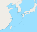
File:East China Sea location map OSM.svg
Jump to navigation
Jump to search


Size of this PNG preview of this SVG file: 680 × 600 pixels. Other resolutions: 272 × 240 pixels | 544 × 480 pixels | 870 × 768 pixels | 1,161 × 1,024 pixels | 1,360 × 1,200 pixels.
Original file (SVG file, nominally 1,360 × 1,200 pixels, file size: 153 KB)
File history
Click on a date/time to view the file as it appeared at that time.
| Date/Time | Thumbnail | Dimensions | User | Comment | |
|---|---|---|---|---|---|
| current | 03:13, 5 October 2019 |  | 1,360 × 1,200 (153 KB) | Geographyinitiative | The maritime boundary lines were straight lines in the ocean- disputed & inexact at best. Also, the ROC-PRC maritime boundary was not included. The best solution for now is not having any lines. A map with exact maritime boundaries would be useful. |
File usage
The following 2 pages use this file:
